Kosciusko Recovers From Morning Storm
[weaver_youtube N3m4SWaonwE rel=0]

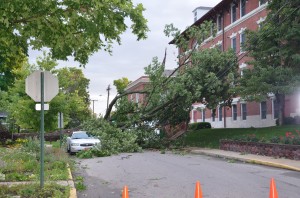
A tree completely blocked Chestnut Avenue in Winona Lake following this morning’s storm but fortunately, did not cause any major damage to the buildings nearby or car parked under it.
(Photo by Alyssa Richardson)
This morning’s storm packed a one-two punch with two lines of storms bringing severe winds that have left numerous trees and power lines down throughout the county and thousands without power. Though many have speculated about the possibility of tornado touchdowns this morning, as of this time, meteorologists with the National Weather Service do not believe this is the case.
“As of right now,” stated Courtney Obegfell, meteorologist with the National Weather Service of Northern Indiana. “Most of the damage is pointing in one direction, indicating straight line winds.”
According to Obegfell, wind speed highs measured at 70 miles per hour with a few areas seeing an excess of 70 miles per hour “given some of the tree damage.”
Obegfell is not alone in her assertion that most debris seen thus far appears to point in one direction. According to Ed Rock, director of Kosciusko County Emergency Management, clean-up crews throughout the county have also seen evidence indicating last night’s storm involved straight line winds.
According to Rock, following the storm the county first worked to clear all debris that did not have power lines mixed in as a representative from a power company would have to be present during those repairs.
Rock also noted that due to the fact that storm damages were widespread throughout the area, power companies must focus their efforts on rebuilding the power grid as a whole. Instead of focusing on individual households or smaller “patches in the power supply”, power companies must first work towards restoring big power lines outlying the area, working down to individual household power outages later.
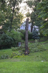
Rock explained that damages were widespread throughout the county with Mentone and Winona Lake showing significant damages. “A lot of damages seemed to be the result of weak power line poles or weak limbs,” explained Rock. “All it takes is one rotted limb to bring a big piece down. Most damages should be cleaned up today.”

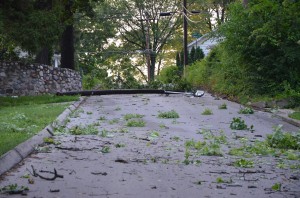
Road were blocked in many areas of the county due to downed tree branches and power lines following this morning’s storms.
(Photo by Alyssa Richardson)
According to Oberfell, NWS was watching two lines of storms, the forming in Iowa, the first storm was heading eastbound and fizzling out. The second line provided “the main punch as it mode through overnight causing the wide spread damage.”
The NWS issued a tornado warning at 12:36 a.m. as the storm they were tracking showed the possibility of rotation being indicated on radar. That initial warning was for northwestern Kosciusko County and lasted until 1 a.m. However, shortly before that warning expired, it was extended until 1:30 a.m.
Oberfell noted the fatality in Winona Lake occurred around 1:15 a.m. just before the major portion of the storm left the area.

