Earthquake Saturday Reveals New Fault Line In Michigan

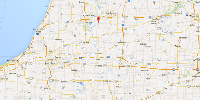
The red flag on the map indicates the approximate epicenter of the earthquake in Scotts, MI. (Google maps)
The earthquake felt Saturday, May 2, throughout southern Michigan and northern Indiana has revealed a new geological fault line in Kalamazoo County.
A Michigan State University scientist wrote a paper 20 years ago suggesting the possibility of the fault line, but the existence had remained unproven until now.
“I always thought there was something there because of variations in the magnetic field,” stated Kazuya Fujita, MSU geosciences professor. “When I heard the quake was in Kalamazoo, I figured it was probably that fault.”
According to data collected by the U.S. Geological Survey, the epicenter of the May 2 quake was in Scotts, MI, a rural farming community about 12 miles southeast of Kalamazoo. Maps that have been created from the data match “almost perfectly” with Fujita’s theory.
“It looks like the fault goes between Coldwater and Kalamazoo,” said Chris Schmidt, a geoscientist for Western Michigan University. “If it goes north of that, we don’t know, and we’re not sure if it goes further south.”
Based on the survey data, the fault line is approximately four miles underground. It is a strike-slip fault, which is a vertical fracture where the blocks move horizontally. At 12:23 p.m. May 2, the northeast side of the fault suddenly shifted northwest while the southwest side slid southeast, releasing tension that had been building for years between the blocks, Schmidt said.
The movement, which may have only been a few feet, triggered a 4.2 magnitude earthquake felt in five states and southern Ontario, Canada.
Historical records make reference to an earthquake in nearby Climax, MI, in 1883. The state’s largest quake on record occurred in Coldwater in 1947, 64 years later. Now, 68 years after the Coldwater quake, another one has occurred along what seems to be the same fault line.
“So in 65 years or so, we might – exclamation point, might – get another,” said Schmidt.
Source: Kalamazoo Gazette
