Wawasee Implementing New Transportation Software

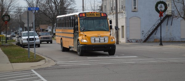
A Wawasee school bus coming from Milford School in the afternoon is stopped at the four-way stop at Main and Emeline streets in downtown Milford. New transportation software is being implemented in the Wawasee district and it is hoped it will increase efficiency, improve service and reduce costs.
School bus routes can change literally from day to day due to family situations and other factors. A student may ride one bus for a few days to go to one parent’s house and then ride a different bus to the other parent or a grandparent.
Trying to manage those routes and keep track of where buses and students are at a given time can be a huge task. But today’s GPS and mapping technology is one option that can be used to more efficiently manage transportation systems.
Earlier this year, the Wawasee school board approved the purchase of Transfinder software to be used by the Wawasee school district. Other components of Transfinder include Routefinder Pro, Infofinder LE and Servicefinder. Bob Lahrman, director of support services, and Todd Smith, administrative assistant at the transportation building, have attended training sessions for Transfinder.
Lahrman noted the software for the fleet management system used by Wawasee was becoming obsolete and no longer supported. “It would have cost a lot to upgrade, so we had to do something,” he said. After checking other software products, Transfinder was eventually chosen.
“It seemed like it is easier for a smaller school district to use Transfinder,” he noted. And it is already being used by the nearby Wa-Nee Community Schools and they seem pleased by its results.
Transfinder will not only enable the scheduling of the bus fleet for service and maintenance, but it will also give Wawasee a new tool. “We never had anything (computer software) for bus routing before,” Lahrman said. “The bus drivers used a map to set up their routes.”
Transfinder also enables field trips to be set up and scheduled online, provides needed route data to building administrators and will be tied in to the student management system.
Purchasing the software was also the result of an intention to provide better transportation service within the Wawasee district. “We want to be more efficient, improve service and see how we can save some money,” Lahrman noted.
Implementing the software system is a several step process. Each student in the district, even those walking to school, have to be “geocoded,” or their house locations pinpointed on a map. Bus routes will be built step by step and drivers will click on handheld units each time they stop and leave along their routes so the system will know the path of the bus and how long a bus remains at each stop.
Specifically for Wawasee, Lahrman said Transfinder should particularly help substitute bus drivers see where their route is and where the stops are. Presently, sub bus drivers actually sometimes rely on students to help them after the first few stops. Smith noted Transfinder may show drivers new ways to do a route they had never thought of before.
And the system will notify whenever there is a new student and where they would be located along a route. “We should be able to track students who are on different bus routes,” Lahrman said, speaking of those who ride one bus a few days and then change buses.
The goal is to have the new system ready to go by the start of the 2015-16 school year, though Lahrman and Smith admitted there is still much work to be done.
